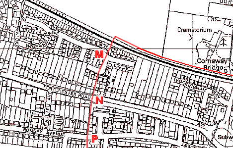
Naval Fuel Pipeline

 Created 11-04-2005   Last update 15-04-2007

<

Fuel Pipeline

page 4 of 5

>

 Fuel Bunkers


Winnam Drive

 West of the Crematorium the pipeline turns south where a  title deed from the 1960s shows an 'Admiralty Casement' under the Railway Line. 

Google Earth Aerial View


Winnham Drive Culvert

Location 
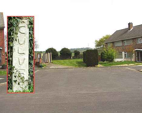
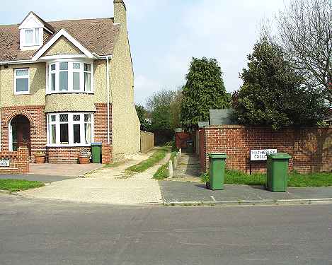
M, Winnham Drive looking north, where the pipeline crosses the south coast railway line. This side of the railway line, in the centre of the photo, is a rough cast white marker post (see inset) with the word 'CULVERT' inscribed on it. There is no sign of anything else on or around the railway track.


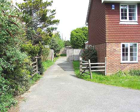
There used to be two large circular metal covers at this location and twice a year a man used to come to the site, lift the covers, climb down the shaft, walk through the shaft and appear on the other side of the railway. This access was concreted in when the pipeline was decommissioned.


Contributor: Gary Smith - April 2007


A27

Location N looking north west with the A27 (Portchester Road) in the foreground. The pipeline runs along the left-hand side of the tiled house on the  right of centre.


North of A27

Looking north along the driveway of the house shown in the previous photo. Beyond the fence at the end is Winnham Drive. The former owner of this property applied to built an extension on the side of this house but planning consent was rejected because of the pipeline and its residual contents.


Romsey Road

Location P looking north in Romsey Avenue. The pipeline is under the driveway alongside the house.


<

Fuel Pipeline

page 4 of 5

>

 Fuel Bunkers