WWII Invasion Defences

Interdiction Battery

 Created 20-05-2001   Last update 19-08-2002


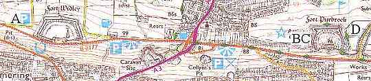
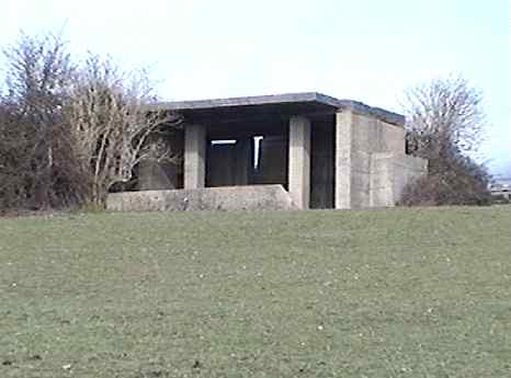
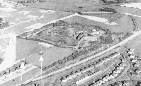
Centered around Fort Purbrook is an Interdiction Battery. This term is used in the context of prohibiting or denying land based invading forces from gaining possession of a particular area of ground or sea, which in this case would have been everything visible from that Interdiction site - east Portsmouth, Langstone Harbour, Hayling Island and Chichester Harbour. It was also intended that the Hayling Island bridge was to be shelled if that Island fell to the enemy.

The 
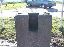
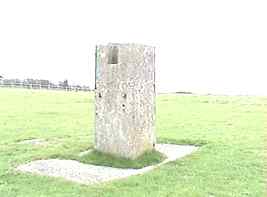
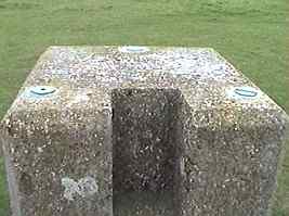
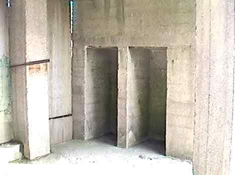
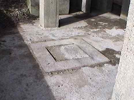
site consisted of 2 main components: two concrete plinths, a known distance apart, on which direction and range finding equipment would be set, and 2 guns housed in casemates. Accurate gunlaying could be obtained by triangulating between the two plinths, which were commonly called 'end bases'.


With thanks to

Peter Cobb of the UK Fortifications Club

 
interdiction site OS map

The map shows the location of the components

 of the interdiction battery

A Gun laying plinth west of Fort Widley Still exists SU653065
B Casemate for the west gun Still exists SU675064
C Casemate for the east gun Demolished late 1990s SU676064
D Gun laying plinth east of Fort Purbrook Still exists SU680065
Image produced from the Ordnance Survey Get-a-map service. Image reproduced with kind permission of Ordnance Survey and Ordnance Survey of Northern Ireland.


plinth west of  Fort Widley - long shotplinth west of  Fort Widley - close up

Location A in the map above.

Bearing and range finding plinth, west of Fort Widley. The copper studs in the top of the plinth are missing. On the right hand side of the plinth near the bottom is a benchmark, almost visible in the left hand photo. 

 Aerial photo site location


Location D in the map above.

About 150 yards east of Fort Purbrook in the middle of a field is the eastern bearing and range finding plinth. The distance between the two was 3,000 yards exactly.

The different shaped copper studs set in the top are for accurately locating the optical equipment. Nearby was the HAVANT ROC monitoring post.


AA gun site

 Location B in the map above.

This is the western casemate and is located to the west of Fort Purbrook The back of the building was originally open, the same as the front, and is protected by a blast wall. The concrete feature sticking out on the right is an immediate expense magazine; there is another one on the left. 

Aerial photo site location


gun site magazines

 A view of the magazines. The structure looks in good condition here, but the roof is cracking and is perforated in places. There are no underground features, so I guess there was a surface magazine nearby. The eastern casemate, now demolished (C in the map above), had its own underground magazine.


gun site - gun mount

 The gun mounting. This would have supported a four inch OBL (Obturation Breech Loading) gun, manned by the Royal Artillery.


1969 aerial photo Fort Purbrook

 This is an aerial photograph taken in 1969 of Fort Purbrook during the development of Crookhorn Golf Course and the new Crookhorn road. The two interdiction casemates are arrowed. The casemate nearest the fort suffered the ultimate act of wanton vandalism in the 1990s when it was demolished by Portsmouth City Council. The wide chalk scar just above the Fort is the new Crookhorn Road under construction. 

Photo supplied by Peter Rogers