Aerial Photographs of Portsdown

 Created 13-06-2009    Last update 15-06-2009

<

Portsdown Aerial Photos

page 2 of 4

 >


Forton Fuel Depot - Gosport

Forton Lake divides the former ammunition depot Priddy's Hard (top), from the Forton Fuel Depot (bottom). The pipeline from the Fuel Bunkers on Portsdown terminates here.


Priddy's Hard, Forton Fuel Depot and the fuel jetty

From the bottom: Priddy's Hard, Forton Lake, Forton Fuel Depot, and left of centre the long refuelling jetty where FFO was pumped to and from the Portsdown fuel bunkers. The Spinnaker Tower is on the extreme left and the small island, centre left, is Burrow Island.


Fleetlands and Frater

To the left is the Royal Navy Armaments Depot and to the right is Fleetlands. Neither of these locations is called by these titles anymore, but they change their names so often I have given them their most popular 'local' names. The Fuel Pipeline runs between them and crosses Fareham Lake to the left of the slipway and the bottom of the photo. At least it would have done: it's been removed now.


Portdown Hill looking east

Looking east along the crown of Portsdown Hill from the Fareham end. Fort Nelson is centre left (the white V shaped magazine is visible). Notice how the 3D element of height seems to be missing; everything looks flat despite the fact that this is a 300 foot hill. This is not an illusion caused be the camera; it really looked like this.


Southwick House

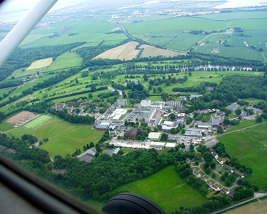
Southwick Park, formerly HMS Dryad. In the centre is Southwick House of Operation Overlord fame. This is 1 mile from the WWII Underground Communications Centre at Fort Southwick.


Pigeon House Farm

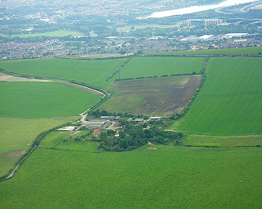
Pigeon House Farm on the north slope of Portsdown. The darker field in the centre of the photo is where Sergeant HH Adair's Hurricane crashed during WWII.


<

Portsdown Aerial Photos

page 2 of 4

 >