Aerial Photographs of Portsdown

 Created 13-06-2009    Last update 15-06-2009

<

Portsdown Aerial Photos

page 4 of 4

 >


Fuel Bunker North Entrance

The northern portal of the Naval Fuel Bunkers is lower centre. Above this is the 'top compound' (the green rectangle). The road at the bottom of the photo is Crooked Walk Lane. In the far distance (top left) is Portchester Castle.


In the centre is Christ Church which has revealed several areas of interest for this website. The A3 runs from bottom right to top left, and the B2177 on top of Portsdown is in the right corner. The site of Gob's Barrow is between the B2177 and the Church.


Farlington Redoubt

Looking west along the crest of Portsdown Hill. In the foreground are the remains of Farlington Redoubt. The B2177 runs bottom to top on the left. Up from the Redoubt is a clump of trees: Dead Man's Copse. The scar above that is the Crookhorn Cutting and above this is Fort Purbrook the site of several Legendary Tunnels. On the far side of the Redoubt (right of centre) is a radio mast, site of an ROC Monitoring Post.


Fort Purbrook

A closer view of Fort Purbrook. The buildings in the distance (centre), beyond the golf course, are where Crookhorn Redoubt once stood. A tunnel is thought to link the two Forts together.


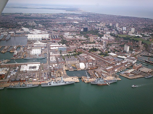
Portsmouth Dockyard

HM Naval Base Portsmouth more generally known as Pompey Dockyard. Southsea, part of Portsmouth, lies behind that with Hayling Island in the far distance. The second ship from the left is the first of the new Type 45 Destroyers: HMS Daring.


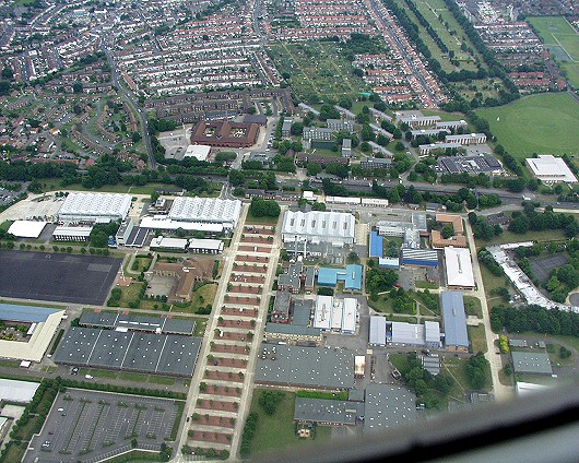
HMS Sultan

HMS Sultan, Gosport. This is the home of Royal Naval School of Marine Engineering (RNSME) and the Royal Naval Air Engineering and Survival School (RNAESS), and, it's where I work. You can tell it's Friday afternoon by the empty car parks!


<

Portsdown Aerial Photos

page 4 of 4

 >