|
|
|
|
|
|
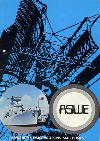
The
front cover illustration from an ASWE recruitment information pack of
1974. The ship is HMS Bristol (D23) the only Type 82 Destroyer to
be built. The featured radar is a STIR (Surveillance and Target
Indication Radar) manufactured by Marconi with two back-to-back
aerials and was to be known as Radar Type 1030 when in naval
service.
Source:
Andrew Taylor
Photo Interpretation: Dave Spencer
(ship)
Paul Mayo (radar)
|
|
|
|
|
|
|
|
|
|
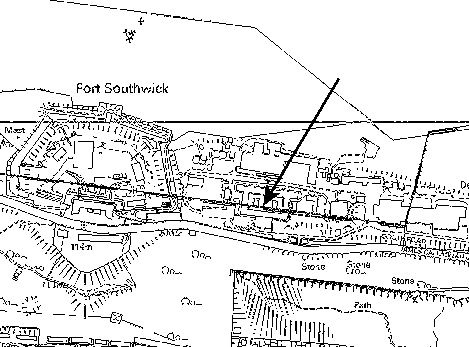
Map 1
This
shows the position of Portsdown Main (arrowed) in relation to Fort
Southwick to the west and Paulsgrove
Chalkpit to the south. The road running along Portsdown at
this point, formerly called Military Road, was adopted by
Portsmouth City Council in February 1997 and renamed James
Callaghan Drive in honour of the former prime minister who was
born in the city.
|
|
|
|
|
|
|
|
|
|
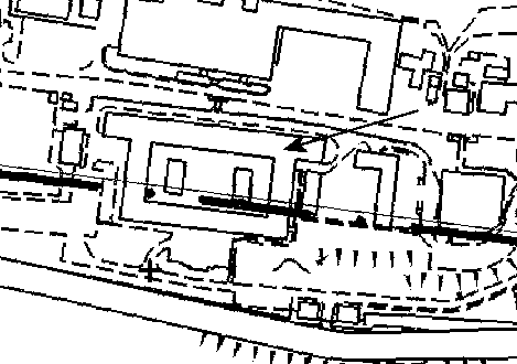
Map
2
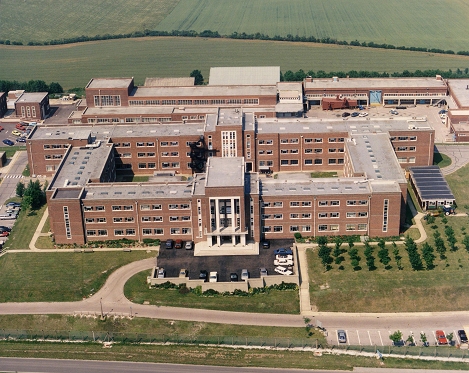
Portsdown Main is arrowed and it can be seen that the building was
rectangular with a central quadrangle or light well. The boundary
line of Hampshire County Council to the north and Portsmouth City
Council to the south runs right through it which made planning
applications a nightmare.
|
|
|
|
|
|
|
|
 |
|
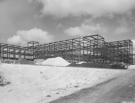
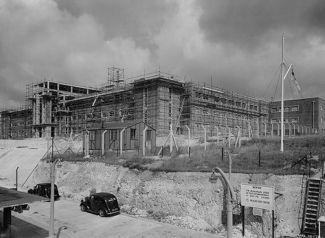
1953 looking west. The main block has its steel work in place.
Source: Paul Mayo
|
|
|
|
|
|
|
|
 |
|
1954 looking south east. The main block begins to take on its
familiar shape. Just 57 years later the bulldozers would be here
for a very different reason.
Source: Paul Mayo
|
|
|
|
|
|
|
|
 |
|
NEW: 06-08-2019
Portsdown Main shortly after is was built.
Source: Mike Dobson
|
|
|
|
|
|
|
|
 |
|
NEW: 06-08-2019
I could be wrong, but I think this was the cafeteria.
Source: Mike Dobson
|
|
|
|
|
|
|
|
 |
|
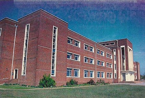
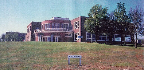
1985 - Portsdown Main displays its full glory.
Source: Paul Mayo
|
|
|
|
|
|
|
|
|
|
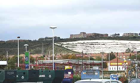
On
the right of centre skyline is Portsdown Main a prominent
Portsmouth landmark as seen from Tesco's car park at North Harbour.
To the west (left)
Fort Southwick can be made out and below the building
is the
Paulsgrove Chalkpit.
|
|
|
|
|
|
|
|
 |
|
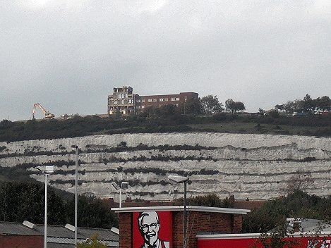
25 September 2011 - Tesco's car park. The west wing has gone and
the central structure is all but destroyed. The Colonel is the
only one still smiling.
|
|
|
|
|
|
|
|
 |
|
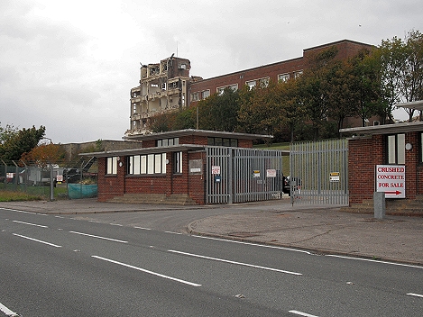
22 September 2011. The photo (and the sign on the right) speaks
for itself.
|
|
|
|